Field Guides
Maps
Before each shoot I draw a scout map — light, route, timing. Hand-illustrated artifacts, never photographs. The map is a tool, not the territory; the photograph is what comes after.
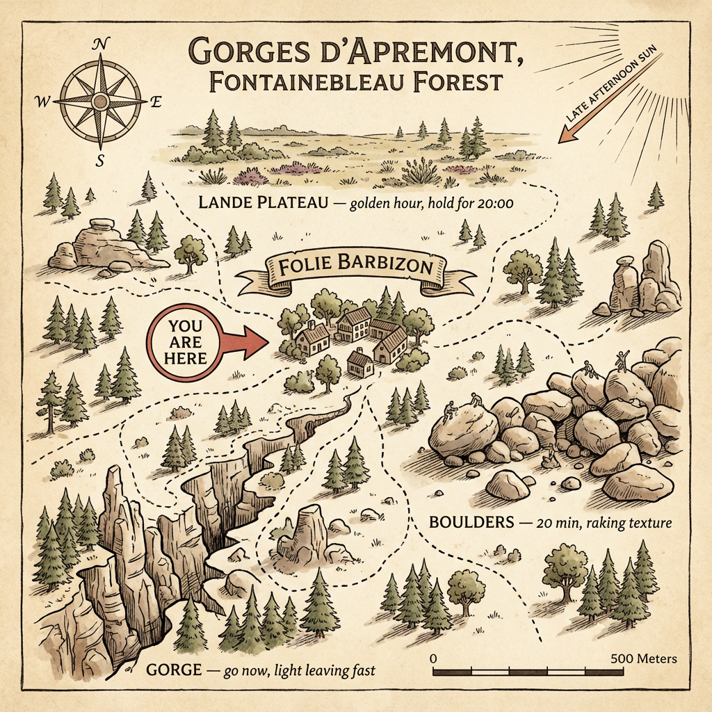
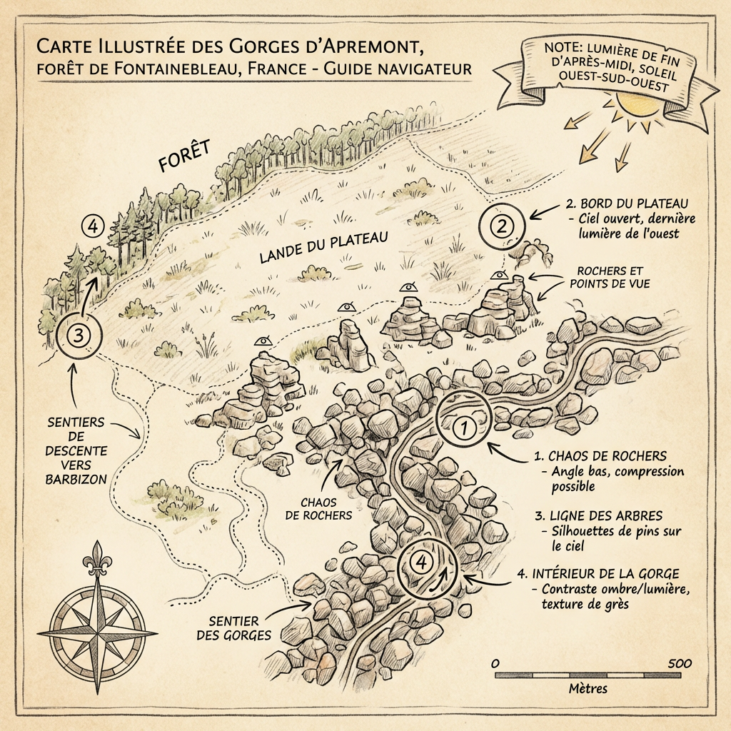
Gorges d'Apremont, Fontainebleau Forest
Folie Barbizon — late afternoon scout
Lande Plateau golden hour 20:00 · Boulders 20 min raking texture · Gorge: light leaving fast
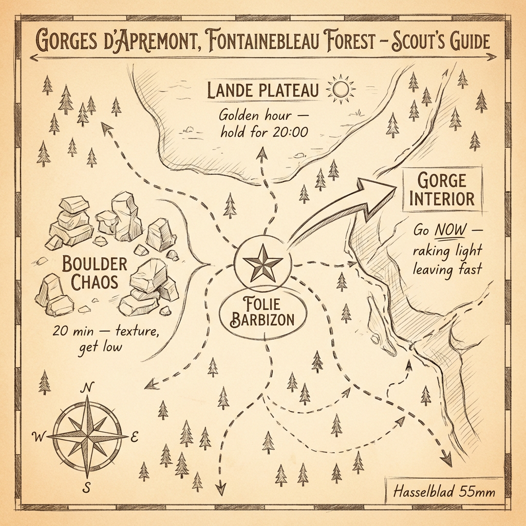
Gorges d'Apremont, Fontainebleau
Scout's guide — Hasselblad 55mm
Boulder Chaos · Gorge Interior · Lande Plateau
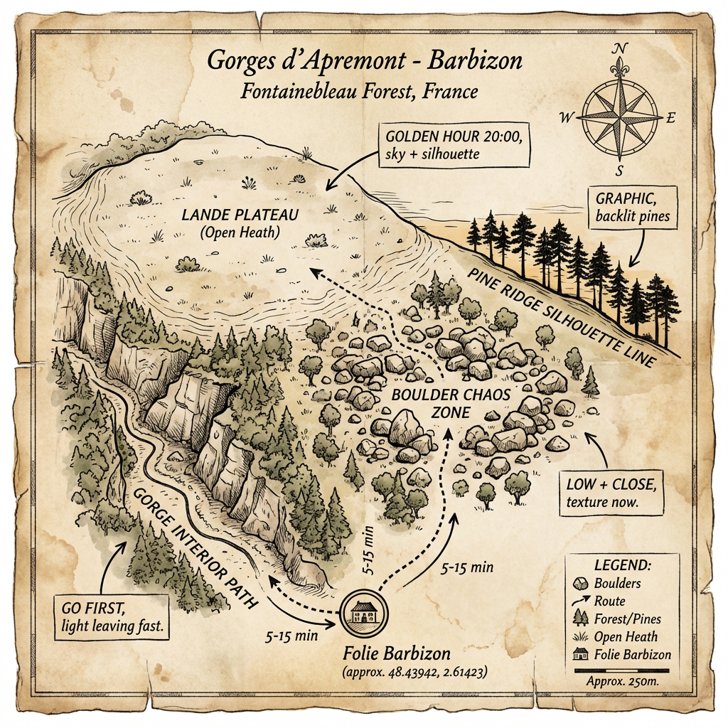
Gorges d'Apremont — Barbizon
Pine Ridge silhouette line at golden hour
Folie Barbizon 48.43942, 2.61423 · 5–15 min between zones
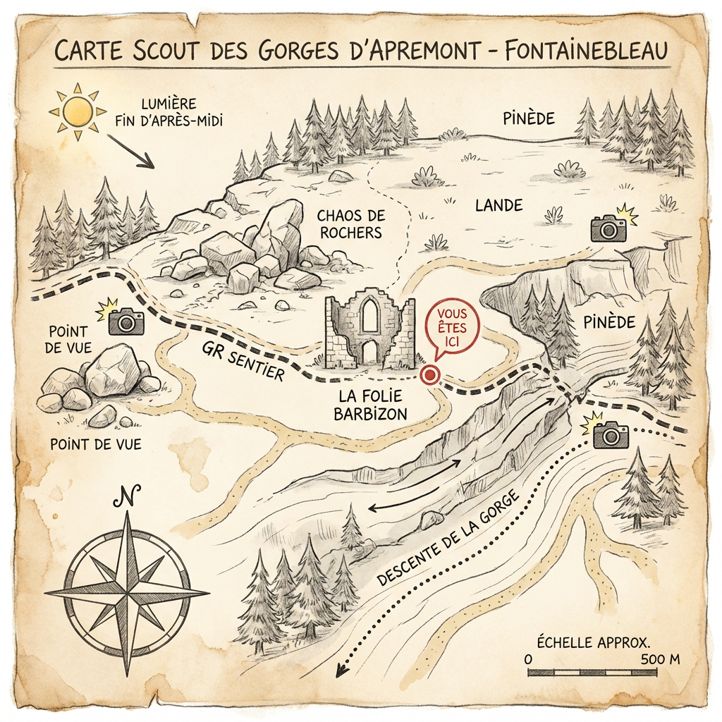
Gorges d'Apremont — Folie Barbizon
Compact scout map
Chaos de rochers · descente de la gorge
Gorges d'Apremont, Fontainebleau
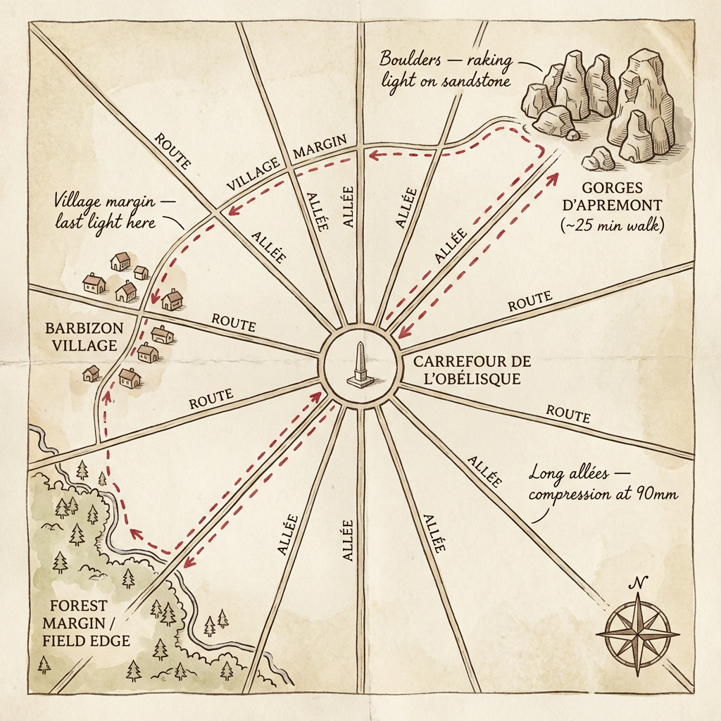
Four-zone navigator (FR)
Chaos de rochers · Ligne des arbres · Intérieur de la gorge · Lande du plateau
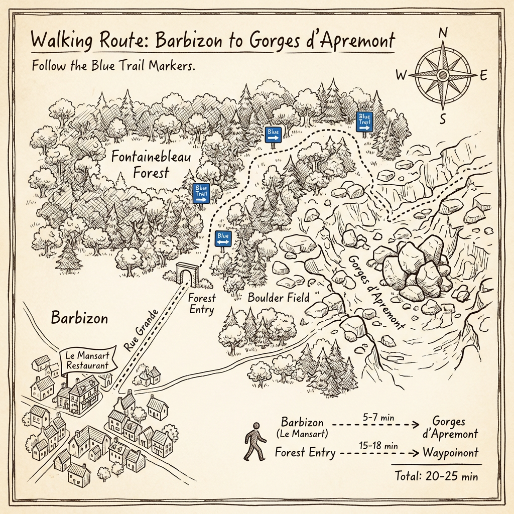
Barbizon → Gorges d'Apremont
Walking route — follow the blue trail markers
Le Mansart → Forest Entry → Boulder Field · 20–25 min total
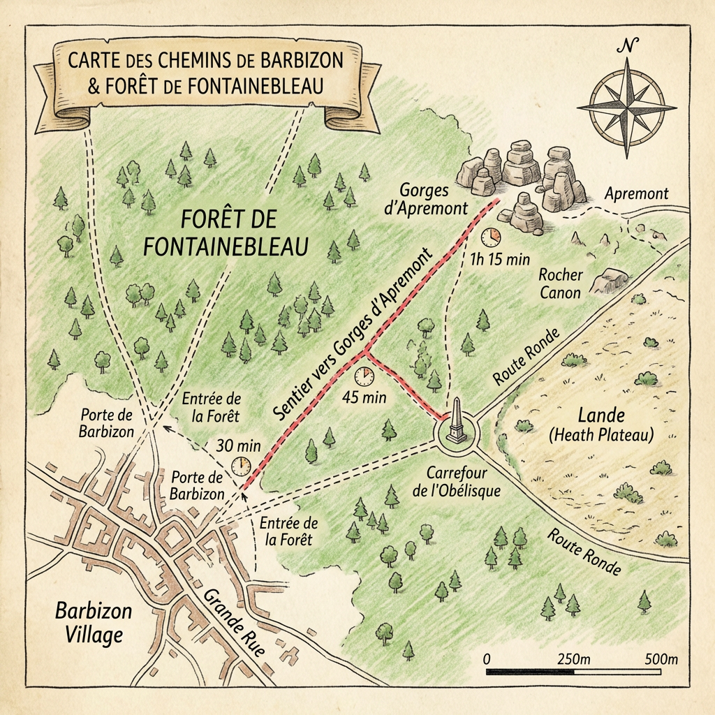
Chemins de Barbizon & Forêt de Fontainebleau
Trail times to Apremont
Porte de Barbizon 30 min · Carrefour 45 min · Apremont 1h 15
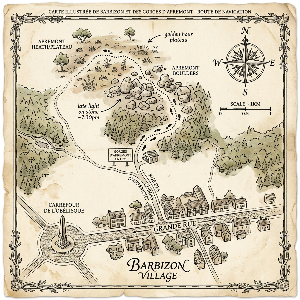
Barbizon Village + Gorges d'Apremont
Carte illustrée — route de navigation
Late light on stone ~7:30pm · Apremont Boulders · Heath/Plateau
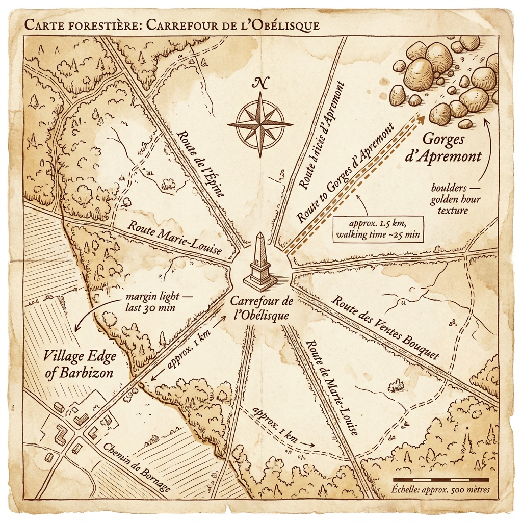
Carrefour de l'Obélisque — Forêt de Fontainebleau
Carte forestière
Margin light last 30 min · Boulders golden hour texture
Carrefour de l'Obélisque
Compact star-route plan
Long allées — compression at 90mm · Boulders raking light
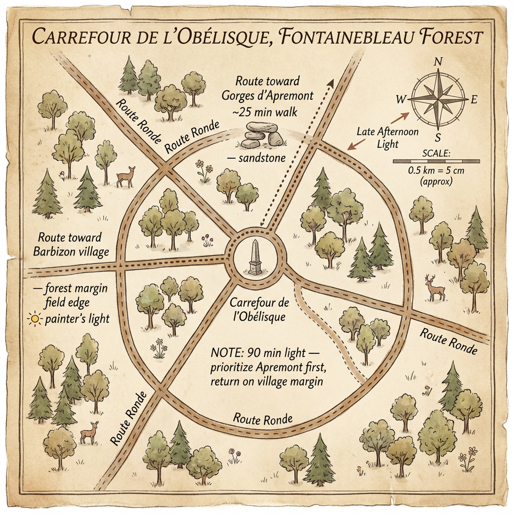
Carrefour de l'Obélisque, Fontainebleau
Star-route navigator
90 min light · prioritize Apremont · return on village margin